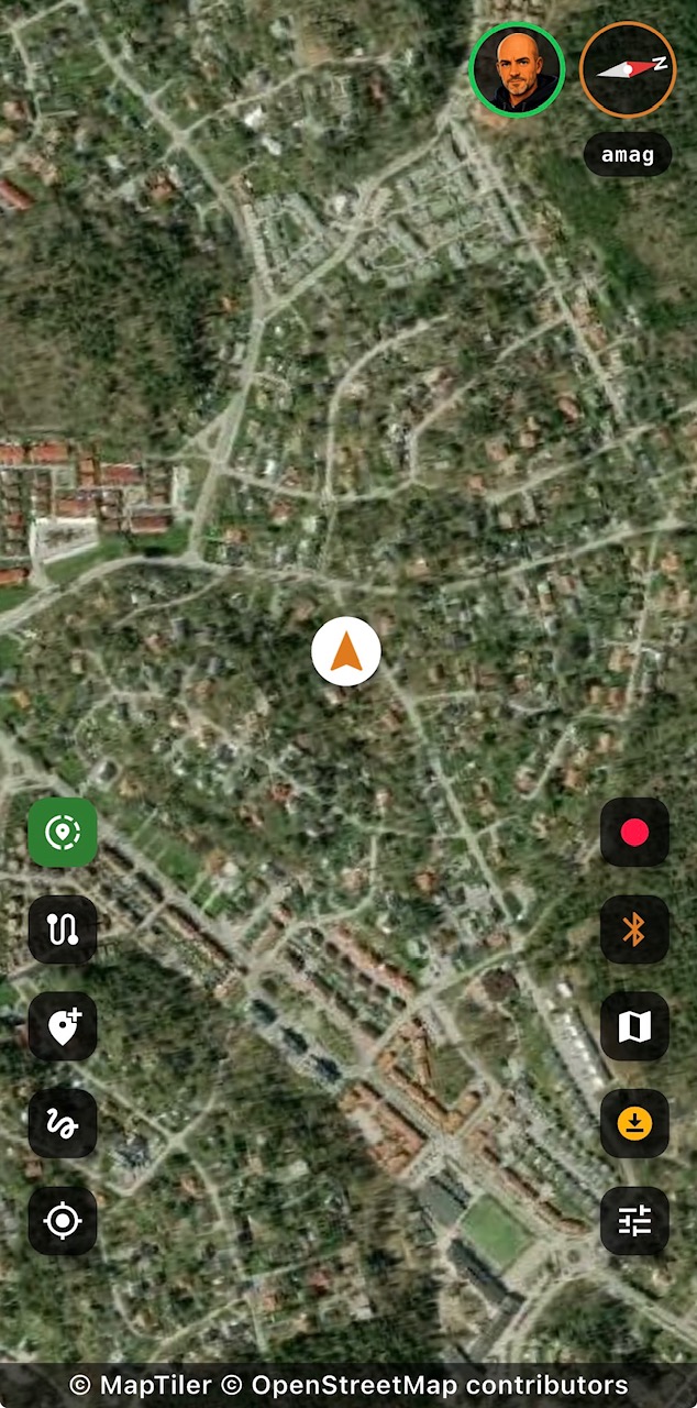
Map & GPS
A live trail map that knows where you are
A crisp vector basemap built for the outdoors — smooth zoom, sharp labels, terrain detail, and a premium satellite layer when you need a real-world view.
- Live position & heading with your recorded path drawn on the map.
- Elevation contour lines so you can read the terrain at a glance.
- Day / Night / Auto map styles for bright sun, low light, and night driving.
- Satellite layer for premium users.
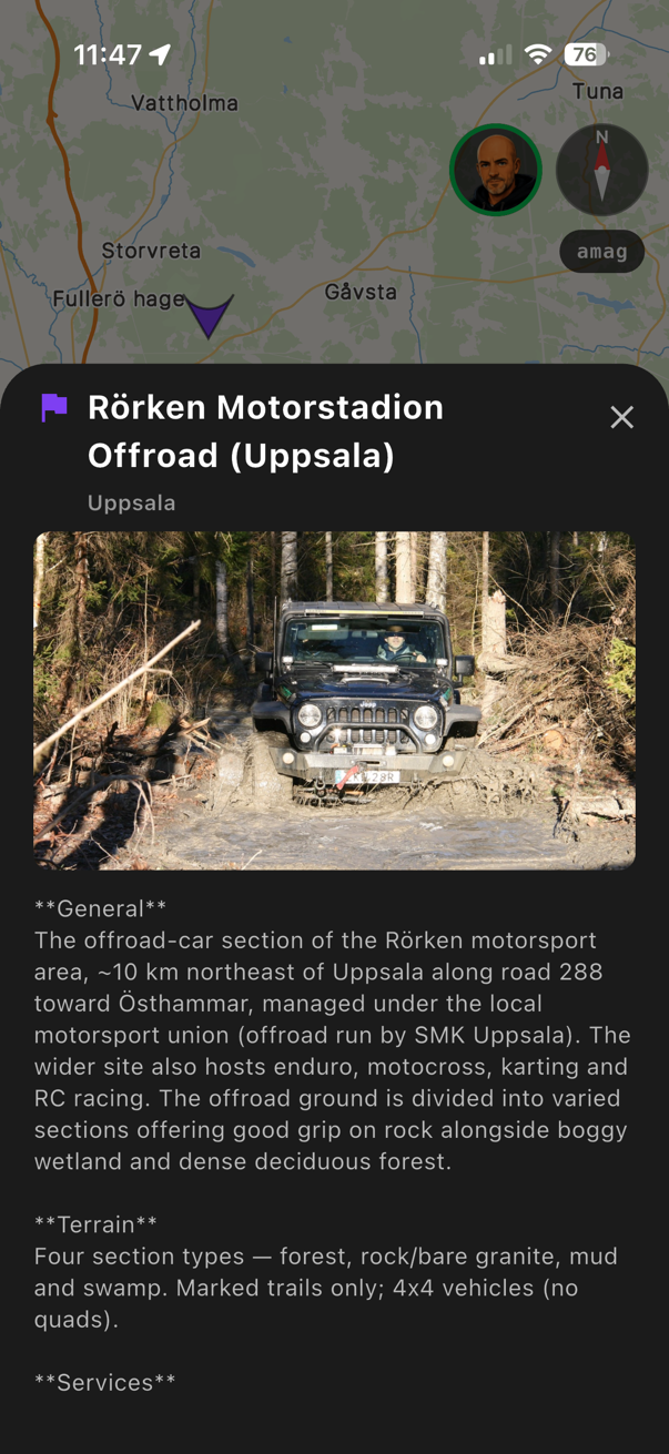
Destinations
Curated places for your next drive
Destinations bring trails, points of interest, and downloadable content into one place.
- Map pins for published destinations.
- Destination details with bundled tracks and points of interest.
- Off-grid download so destination content is ready without mobile coverage.
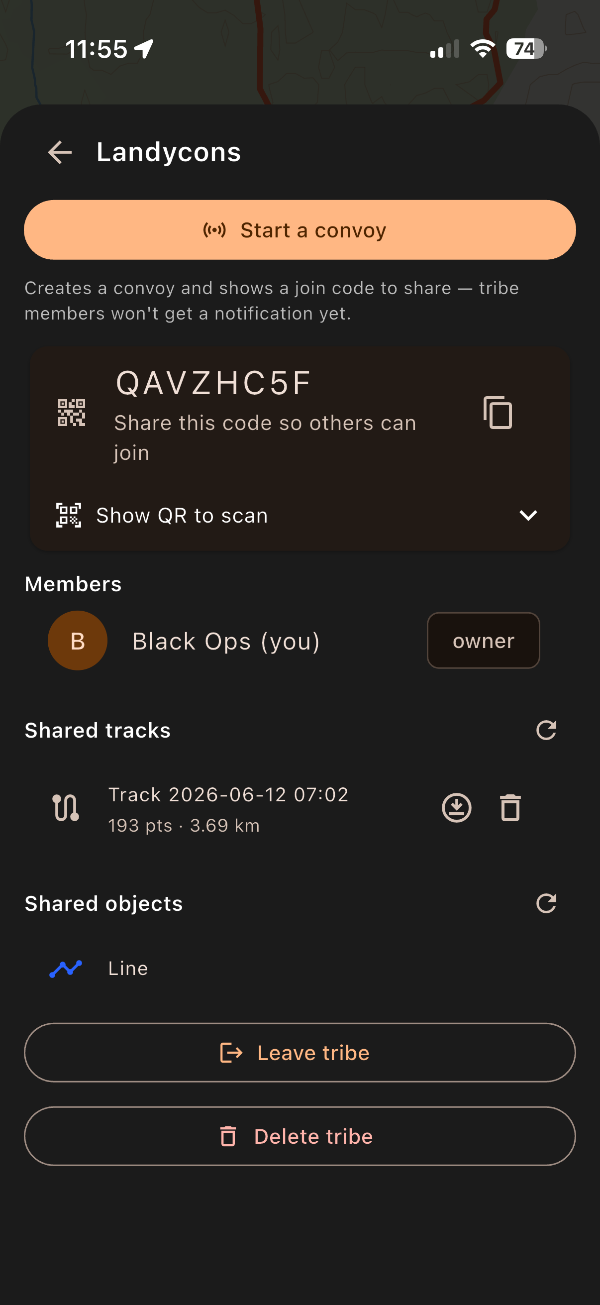
Tribes Beta
Share the trail with your group
Create or join a Tribe for your club, event, or regular driving crew.
- Group track sharing for members of the same Tribe.
- Shared points of interest render in the app today.
- Cloud sync labels make local, cloud, and shared track states clear.
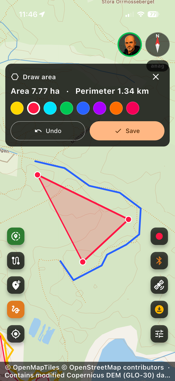
On-map drawing
Sketch routes and measured areas
Draw directly on the map when you need to mark a planned line, a search area, or a boundary.
- Route lines with total length.
- Polygon areas with enclosed area and perimeter.
- Offline-ready drawings saved locally on the device.
Offline area packs Beta
Take the map off the grid
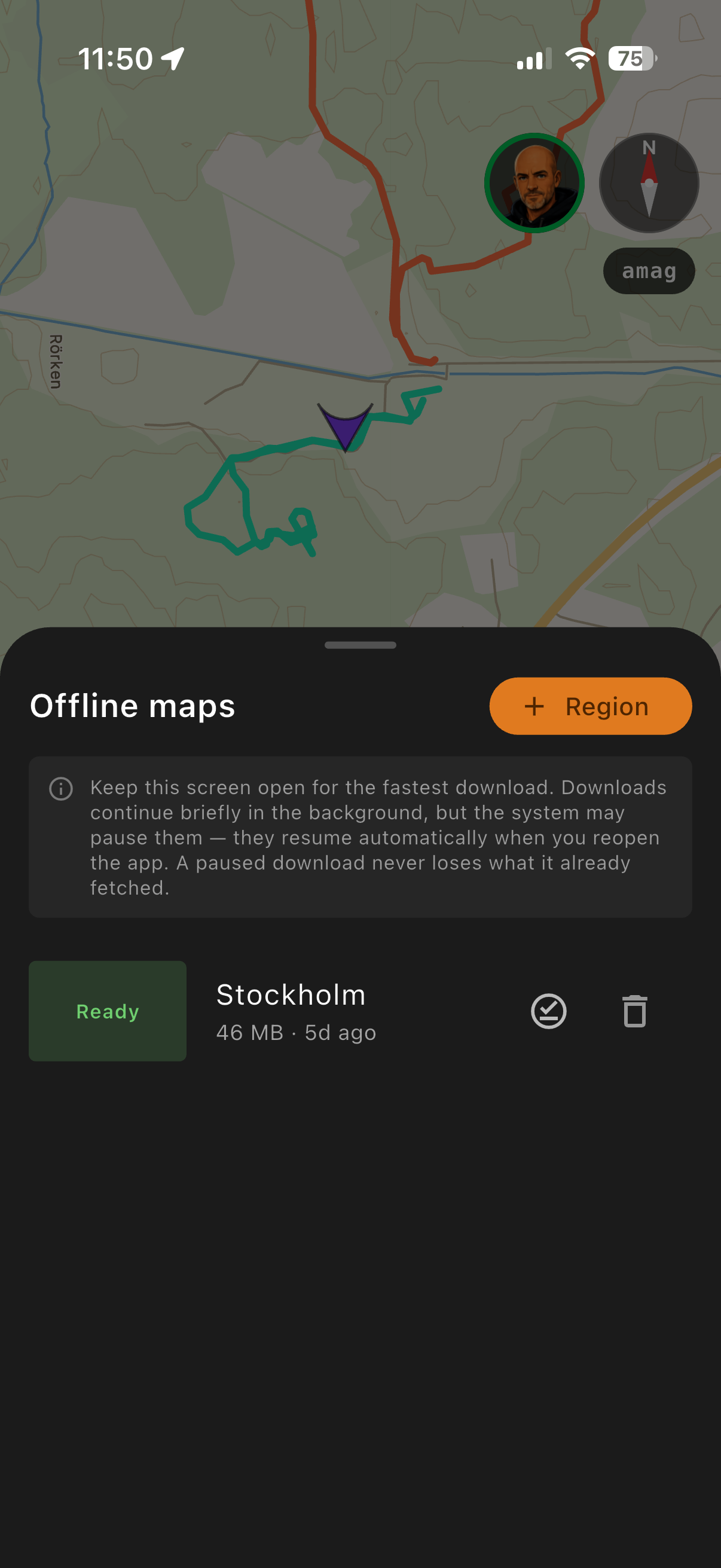
Download areas before you leave coverage and keep the map useful in remote places.
- Offline downloadable vector area packs — roads, places, POIs, and contours render with no signal.
- Resumable downloads with status shown in the app.
- Off-grid mode keeps the interface honest when connectivity drops.
Convoy Beta
Know where your crew is
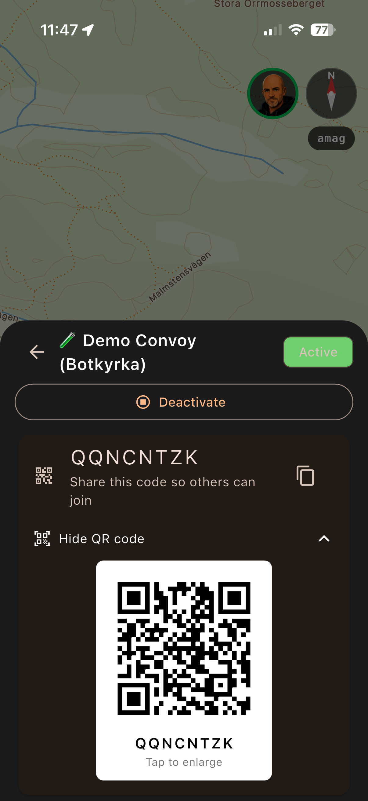
Start a convoy and share live positions with the drivers you are travelling with.
- Join by code, QR, or link.
- Live member dots with heading and call signs.
- Activate / deactivate controls so sharing is explicit.
Vehicle awareness
Tilt, attitude, and engine telemetry
Keep an eye on the vehicle, not just the map.
- Real-time tilt & attitude from your phone's motion sensors.
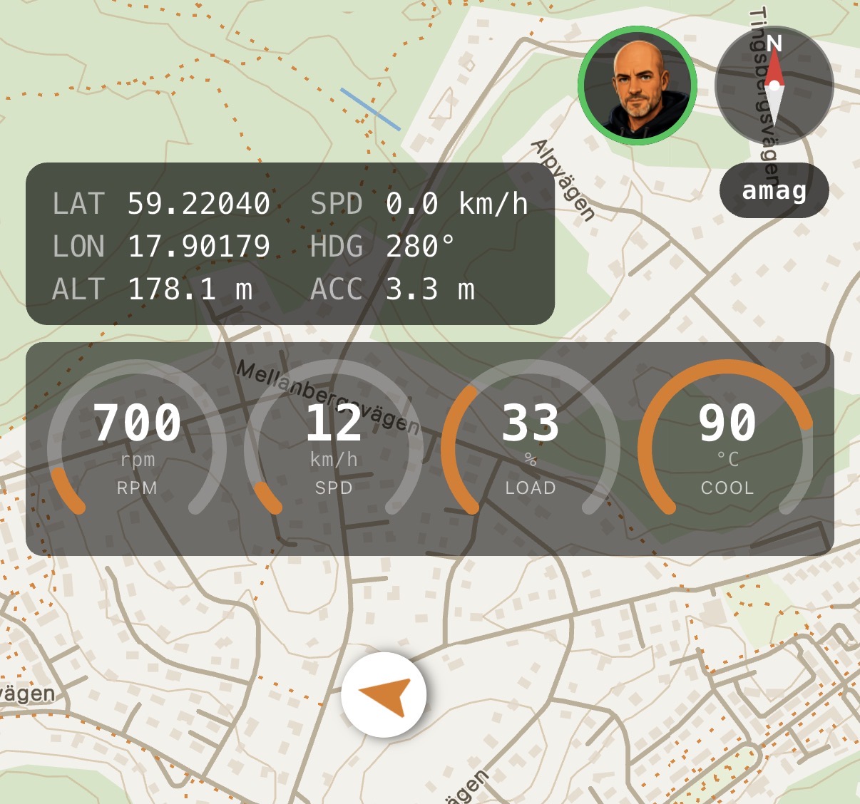
- OBD-II telemetry gauges — RPM, speed, coolant, and more — when you connect a supported adapter.
- Configurable gauges so the panel matches the readings you care about.
Record & review
Record every drive, then replay it
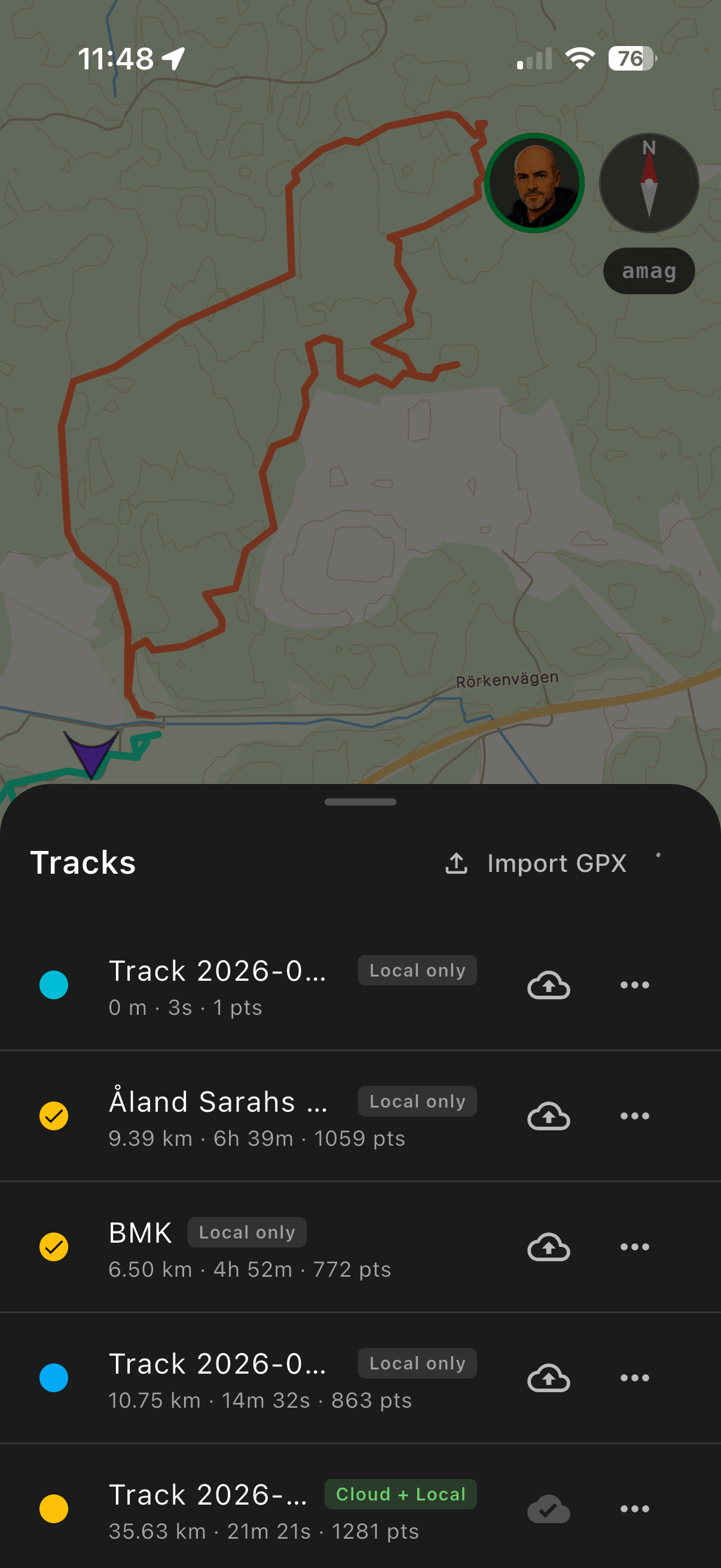
Log tracks on the trail, review the trip afterwards, and move route files between 4x4buddy and other mapping tools.
- Track recording with pause and resume.
- GPX import and export through the native share sheet.
- Post-drive recap stats plus a branded PNG share card.
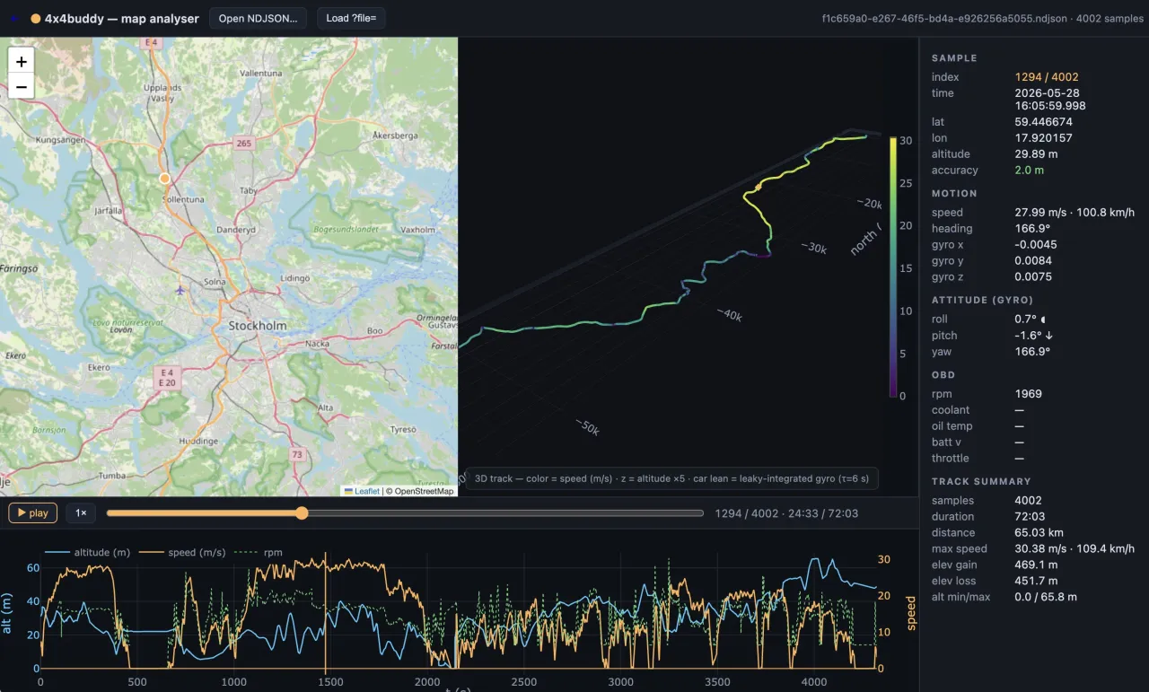
Map Analyser
Replay any drive in the browser
Open a recorded track in the web Map Analyser to study the whole trip — the route on the map, a 3D path coloured by speed, and synced telemetry, all scrubbable frame by frame.
- 2D route + 3D track side by side, coloured by speed with altitude relief.
- Full telemetry read-out — position, motion, attitude, and OBD at every sample.
- Timeline charts & scrubber for altitude, speed, and RPM across the drive.